
I
Field instrumentation
Sensor bars, measurement nodes and an architecture configured according to geometry, depth, accessibility, required coverage and the client’s technical-operational objective.
Hydraulic, thermal or integrated monitoring systems designed for the specific operational case, with online measurement by level and sector, temporal analysis, visualization and indicators useful to operations, metallurgy and engineering.
System
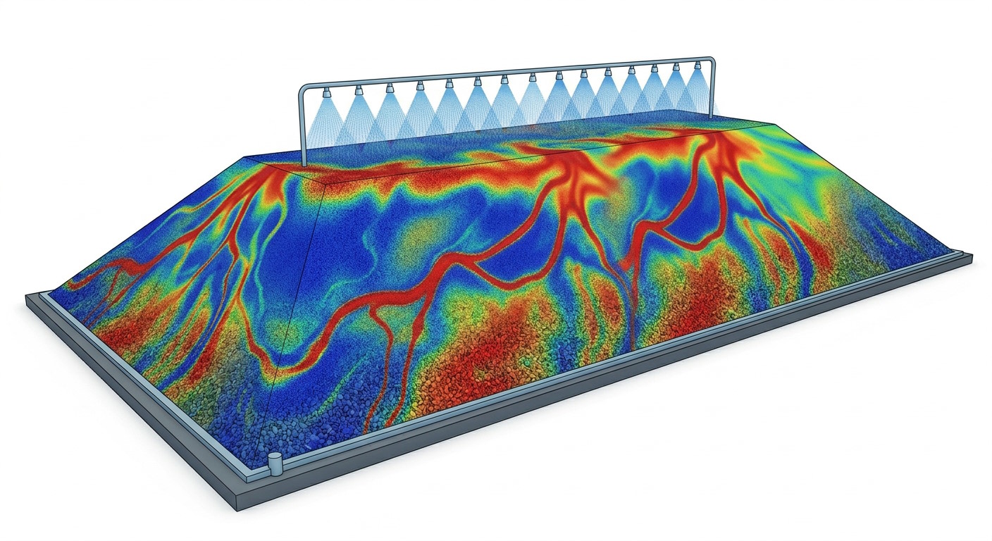
The focus is a critical stage: irrigation enables solution–mineral contact and supports the recovery process.
Sensor bars, measurement nodes and an architecture configured according to geometry, depth, accessibility, required coverage and the client’s technical-operational objective.
Depth-based data to observe internal contrasts, temporal evolution, relative irrigation distribution and, when applicable, complementary thermal variables.
Field data acquisition with communication and power architecture defined according to site conditions, prioritizing wireless alternatives and photovoltaic self-charging when technically suitable.
KPIs, visualizations and technical-operational analysis to prioritize sectors, diagnose current conditions, evaluate irrigation changes, incorporate complementary variables, and support more informed water management.
Complete system
Andes Sigma’s proposal is neither an isolated measurement nor a standard piece of equipment. It is a technology solution designed for each case, bringing together field equipment, data, analysis and visualization to support operational decisions.
Components
Each layer contributes to a traceable path from measurement to decision.
Physical measurement from instrumented heap zones, configured according to the variables of interest, depth and required coverage.
Measurement acquisition, communication and control through an architecture defined for the site, avoiding extensive cabling when a wireless solution is technically suitable.
Photovoltaic self-charging for autonomous field equipment operation under mine conditions.
Temporal data, case-specific configuration, thresholds, visualization, KPIs, operational analysis and technical-operational reporting.
Vertical tomography-like cuts to start analysis in the most problematic zone and manually sweep the heap.
It is not presented as a perfect reading of the entire core without sufficient instrumentation. Its value lies in designing appropriate coverage and building measurable, comparable and useful evidence within the instrumented scope.
Configuration by requirement
We can design the solution with a hydraulic layer, a thermal layer or both, and incorporate other parameters, levels, frequencies and visualizations according to the process, operational objective and site conditions.
Solutions
Each client can request hydraulic monitoring, thermal monitoring or both systems together. We define variables, levels, frequency and visualization according to the process and operational requirement.
Measurement and analysis of relative irrigation distribution and its evolution with depth.
Online temperature measurement and visualization by level and sector.